Snake River, Idaho & Oregon Border
Snake River Map: Hells Canyon Rapids, Route and Gorge
The Snake River runs more than a thousand miles across the American West, and the most dramatic thing it does anywhere along the way is cut Hells Canyon, on the border between Idaho and Oregon. At its deepest, the canyon drops further from rim to river than the Grand Canyon does. It is the deepest river gorge in North America.
Western River offers 79 miles of it, from the launch below Hells Canyon Dam down through Class II to IV whitewater, past homesteads and rapids that river runners have talked about for a century, to the take-out at Heller Bar.
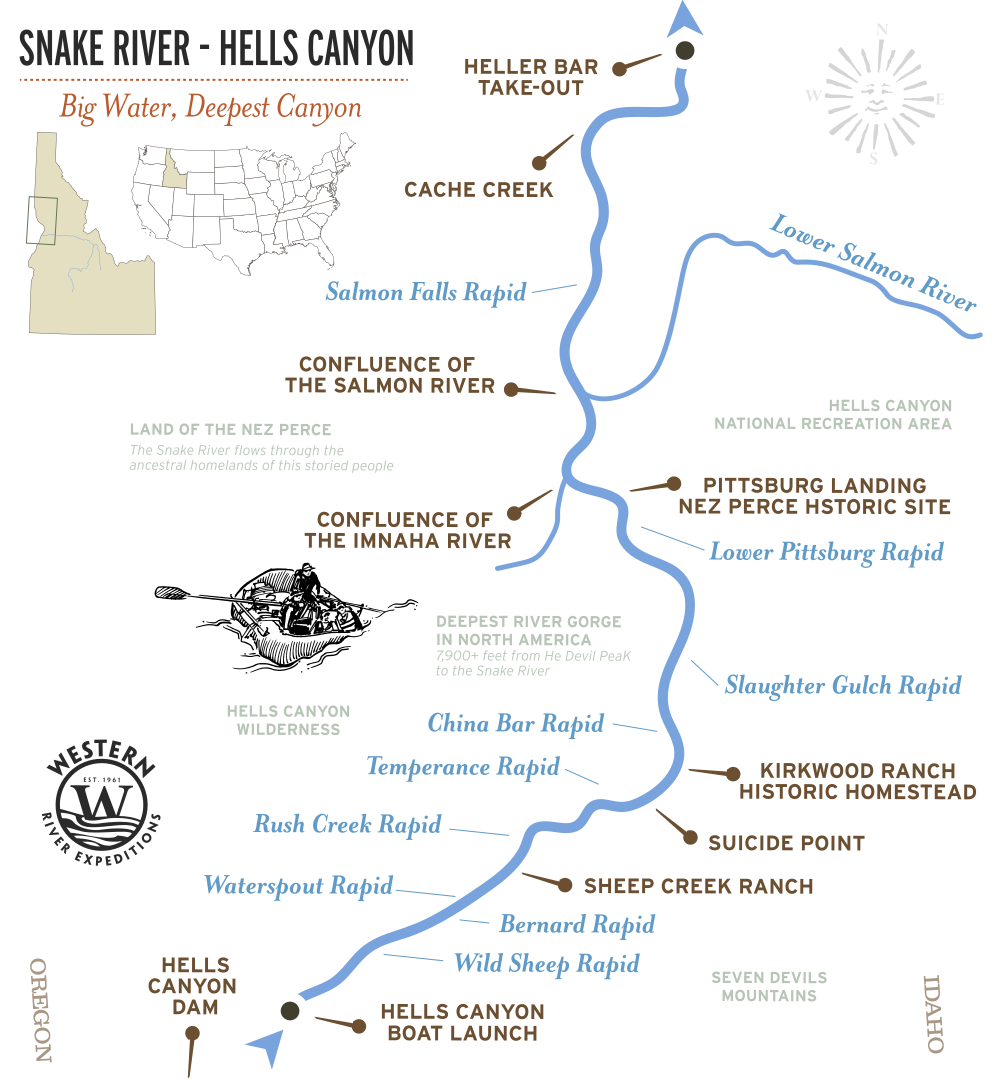
The map below shows the Snake and where Hells Canyon sits on it. The section maps zoom into the run itself: the rapids, the landmarks, and the way in and out. They show many of the places you may see on the river, not every rapid or possible stop.
Quick Facts: Hells Canyon
- Where: The Snake River, on the Idaho and Oregon border
- Claim to fame: The deepest river gorge in North America
- Western River runs: 79 river miles, from below Hells Canyon Dam to Heller Bar
- Rapids: Class II to IV, the largest whitewater in the Pacific Northwest
- Season: May through September
- Trip:
Hells Canyon 5-Day
Sections of the Snake River
The Snake is a long river, and "the Snake River map" means very different things depending on where you are standing. Here it is in downstream order, with the stretch Western River runs called out.
| SECTION | WHERE | WHAT IT IS |
|---|---|---|
| HEADWATERS | Yellowstone, Wyoming | Where the Snake rises |
| JACKSON HOLE | Wyoming | Scenic float country under the Tetons. Calm water, big views |
| SNAKE RIVER PLAIN | Southern Idaho | The long agricultural middle of the river |
| HELLS CANYON ★ | Idaho / Oregon border | The section Western River offers. 79 miles, Class II to IV, the deepest river gorge in North America |
| LOWER SNAKE | Washington | The river below Heller Bar running toward the Columbia |
Hells Canyon Map by Trip
Hells Canyon 5-Day Route
The trip launches below Hells Canyon Dam and wastes little time showing its wild side. After several miles of building anticipation, Wild Sheep and Granite Creek deliver two of the Snake River’s signature whitewater runs—an exhilarating introduction to five days in America’s deepest river gorge.
Beyond that opening rush, Hells Canyon keeps revealing new dimensions. Rapids continue between towering canyon walls, historic homesteads, sandy beaches, and stretches of warm, swimmable water. Over 79 miles, the river carries you through an increasingly remote landscape before reaching Heller Bar near the confluence of the Snake and Grande Ronde rivers..
At a glance:
79 river miles, Class II to IV, 5 days, launch below the dam, take out at Heller Bar.
Trips:
Hells Canyon 5-Day
Hells Canyon Rapids by Mile
Hells Canyon rapids use the International Scale of River Difficulty, Class I to V, the standard system, not the Grand Canyon's 1-to-10 scale.
The river below Hells Canyon Dam is regulated: flows are released from the dam upstream rather than driven by snowmelt, so the Snake here does not spike and fall the way the free-flowing Salmon does. The rapids are big because the canyon is steep and the river is huge, not because it is in flood.
| MILES FROM DAM | RAPID NAME | CLASS | WHAT IT IS |
|---|---|---|---|
| 5.8 | Wild Sheep Rapid | IV | Longest rapid on the river. Powerful hydraulics. |
| 7.8 | Granite Rapid | IV | Relatively short rapid with impressive hydraulics. Lines change at different flows. |
| 13.3 | Waterspout Rapid | IV | Higher water levels will wash out some of this rapid. |
| 15.1 | Sluice Creek Rapid | III | Sluice Creek Rapid features some fun, roller coaster waves. |
| 15.6 | Rush Creek Rapids | IV | Large rock at the top of the rapid in the center of the river. |
| 17.4 | Sheep Creek Rapids | III | There are some rocks to avoid but it is mostly read-and-run. |
| 55.4 | Imnaha Rapids | III | Be mindful of some rocks. At high flows, this rapid typically washes out. |
| 74.8 | Wild Goose Rapid | III | Wild Goose Rapid is a good time. Stay left of the large island, and hold on! |
Counting Miles & Landmarks Along the Snake River
River miles on the Snake River are measured upstream from the Snake River's confluence with the Columbia River near Pasco, Washington - not from Hells Canyon Dam. Although rafting trips launch at Hells Canyon Dam, the official river mile system continues the numbering used for the entire 1,000+ mile Snake River, placing the dam at river mile 247.
| MILES FROM DAM | PLACE | WHAT IT IS |
|---|---|---|
| 0.0 | Hells Canyon Dam | Launch point and beginning of the Wild & Scenic River. |
| 20.2 | Champagne Falls | Spring-fed waterfall cascading directly into the Snake River. |
| 26.5 | Kirkwood Ranch | Historic homestead and orchard preserving the canyon's ranching history. |
| 32.1 | Pittsburg Landing | Major access point and the end of many rafting trips. |
| 58.7 | Salmon River Confluence | Major tributary to the Snake River |
| 79 | Heller Bar Boat Ramp | The end of the Hells Canyon expedition |
How You Reach the River
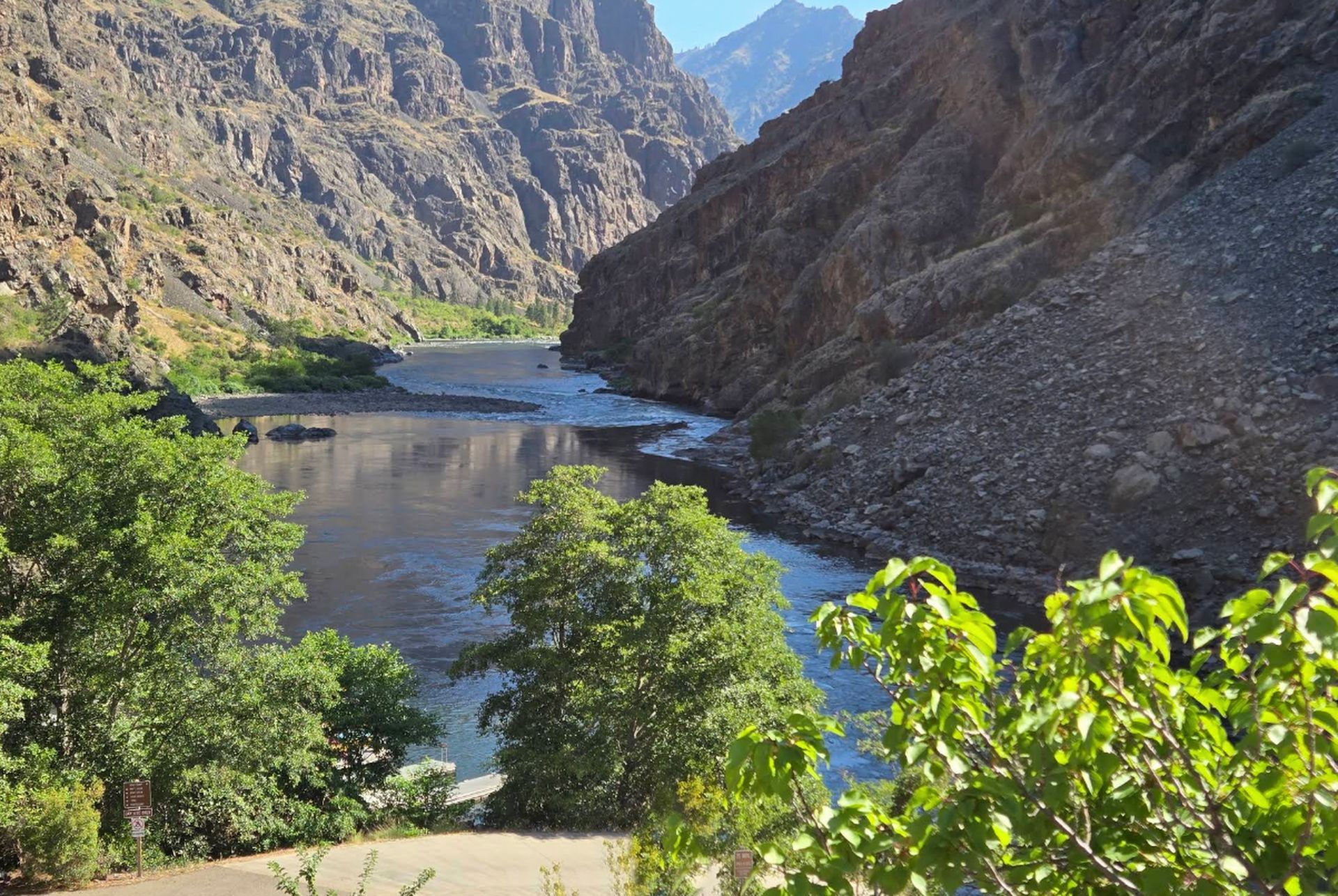
Hells Canyon trips launch from the Hells Canyon Creek Recreation Site, just below Hells Canyon Dam, at the top of the canyon. From there the river carries you 79 miles north, through the deepest gorge on the continent, to the take-out at Heller Bar on the Snake, where the Grande Ronde comes in.
There is no road down the length of the canyon. Once you launch, the river is the way through.
Why Hells Canyon Is the Deepest Gorge in North America
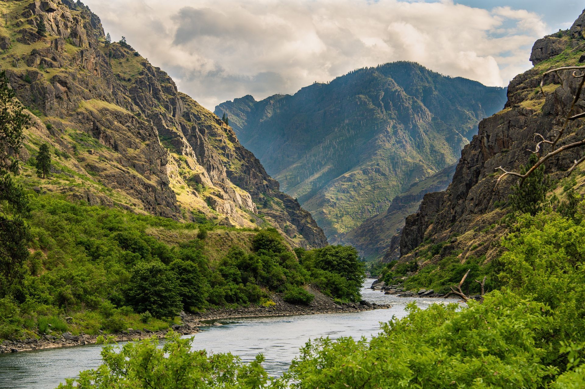
Hells Canyon is often called the deepest river gorge in North America, yet it does not resemble the broad, terraced canyon most people imagine. Its greatest depth is measured from the crest of Idaho’s Seven Devils Mountains to the Snake River far below, a greater vertical drop than the Grand Canyon. Instead of wide red walls and exposed layers of stone, Hells Canyon feels like a mountain range collapsing toward the river.
The Snake River also forms the border between Idaho and Oregon here, with dramatically different landscapes rising from either bank: high, rugged, and forested country on one side; drier, more open slopes on the other.
Get a Waterproof Hells Canyon Map Guidebook
For a map to take on the water, we recommend a waterproof mile-by-mile river guide to the Snake through Hells Canyon, available in the Western River store.
Adventure with confidence
Frequently Asked Questions
Where is Hells Canyon?
Hells Canyon is carved by the Snake River, and forms the border between Idaho and Oregon. It is the deepest river gorge in North America, deeper than the Grand Canyon.
Where does Hells Canyon start and end?
Geologists and historians debate exactly where Hells Canyon begins, but for river runners it starts just below Hells Canyon Dam. Western River Expeditions offers the classic 79-mile route downstream to Heller Bar, where the Snake River meets the Grande Ronde and the canyon begins to open.
What river runs through Hells Canyon?
The Snake River. It rises in the Rockies, at the foot of the Teton Range in Wyoming. It runs more than a thousand miles west before cutting the canyon on the Idaho and Oregon line. It then joins the Columbia River making the border between Oregon and Washington towards the Pacific Ocean.
How deep is Hells Canyon?
Hells Canyon is approximately 7,900 feet deep, making it the deepest river gorge in North America. Its depth is measured from He Devil Peak in Idaho's Seven Devils Mountains down to the Snake River, nearly 2,000 feet deeper than the Grand Canyon's maximum depth.
Where does the Snake River start and end?
The Snake River slithers out of the ancient and dormant cauldron that makes up Yellowstone National Park, passing at the feet of the Grand Tetons, through the Magic Valley of Idaho potato territory, and then descends into Hells Canyon before disappearing into the Columbia River, which forms the border between Oregon and Washington towards the Pacific Ocean.
How hard are the rapids in Hells Canyon?
Class II to IV. The two biggest, Wild Sheep and Granite Creek, come early, both within the first seven miles below the dam. Because the river is dam-regulated, it does not swing with the snowmelt the way Idaho's free-flowing rivers do.
Is there a printable or waterproof Hells Canyon map?
We recommend a waterproof river guide from the NRS store
Still curious to learn more? Contact us.
Plan Your Hells Canyon Trip
Five days on the Snake River through Hells Canyon, the deepest river gorge in North America, with powerful rapids, towering basalt walls, and rich Nez Perce history.
- Begins: Cambridge, ID
- Best for: Rapids & beaches
- Rapids: 40+ Class III-IV
- Ages: June 12+ Jul/Aug 8+
Request Your Free Trip Catalog
Explore our complete collection of rafting adventures across the Grand Canyon, Utah, Idaho and Oregon. This full-color catalog includes detailed trip overviews, sample itineraries, maps and planning guidance to help you compare destinations and choose the experience that's right for you.