Frank Church–River of No Return Wilderness, Idaho
Salmon River Map: Main Salmon Rapids, Forks and Routes
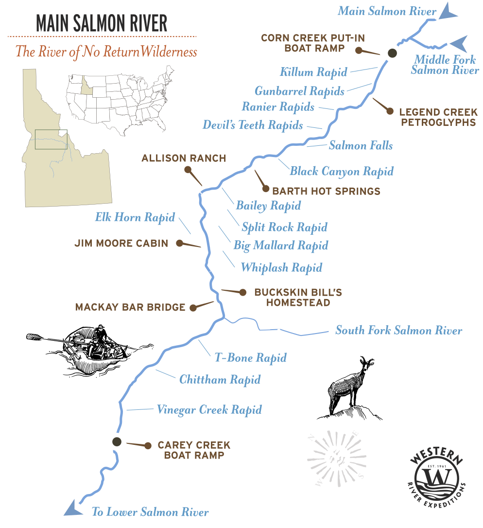
The Main Salmon River flows 82 miles from Corn Creek to Carey Creek through the heart of Idaho's Frank Church–River of No Return Wilderness. This map traces the route of a classic five-day rafting journey, highlighting the major rapids, historic landmarks, hot springs, tributaries, ranches, and other points of interest you'll encounter along the way.
Whether you're planning a trip, following your daily progress from camp, or simply exploring one of America's great wilderness rivers, this map provides an overview of the journey from launch to take-out. For detailed topographic maps, river notes, camps, and mile-by-mile information, get the Main Salmon River Guidebook below.
Quick Facts: Salmon River
- Also called: The River of No Return
- Begins: Corn Creek
- Rapids: Class II to IV
- Season: June through August
- Trip Length: 5 days, 82 miles
- Ends: Carey Creek
Main Salmon River Map
Main Salmon River 5-Day Route
The Main Salmon is the classic River of No Return. The rafting route begins at Corn Creek and follows 82 river miles through the heart of the Frank Church River of No Return Wilderness before ending at Carey Creek, just upstream from Riggins.
Unlike the wilder Middle Fork above it or the tamer Lower Salmon below, the Main Salmon is defined by balance. Long, quiet pools connect lively Class II–IV rapids, broad beaches give way to forested camps, and each day carries the river deeper through one of the largest roadless landscapes in the Lower 48.
The map highlights the major rapids, tributaries, camps, and landmarks that tell the story of this remarkable stretch of river.
At a glance:
82 river miles, Class II to IV, 5 days, Corn Creek to Carey Creek.
Main Salmon Rapids by Mile
The Salmon is free-flowing. There is no dam upstream, so the river runs high and fast with the June snowmelt and settles through the summer. The same rapid is a different rapid in June than it is in August.
| RIVER MILE | RAPID | CLASS | NOTES |
|---|---|---|---|
| Mile 32.6 | Bailey | III | Several holes toward the bottom. Enter right and work to the right. |
| Mile 34.8 | Split Rock | III | Comes after Bargamin Creek enters from the right |
| Mile 20.9 | Black Creek Rapid | III+ | Formed in 2011. Submerged the old Salmon Falls Rapid. |
| Mile 37.8 | Big Mallard | III | One of the names river runners trade |
| Mile 40.6 | Elk Horn Rapid | III+ | Tight run, tall trees |
| Mile 77.2 | Chittam | III | The last one before the take-out |
Landmarks Along the Route
| RIVER MILE | PLACE | WHAT IT IS |
|---|---|---|
| Mile 0 | Corn Creek Boat Ramp | The end of the road into the roadless wilderness! |
| Mile 4.4 | Legend Creek Pictographs | Nez Perce tribal pictographs |
| Mile 20.4 | Start of Black Canyon | Arctic Creek Lodge and former Salmon Falls |
| Mile 23 | Barth Hot Spring | One of the best hot springs in Idaho |
| Mile 33.5 | Allison Ranch Airstrip | Great camp, homesteader museum |
| Mile 43.2 | Jim Moore Cabin | Prospecting for gold... Legend is he left some behind |
| Mile 52.7 | Buckskin Bill's | The homestead of a man who lived alone in this canyon and made his own rifles |
| Mile 55 | Mackay Bar Bridge | Bridge was built in 1935 |
| Mile 56 | South Fork of the Salmon | Tributary comes in from the south |
| Mile 81 | Carey Creek Boat Ramp | This is the take-out. End of trip. |
How You Reach the River
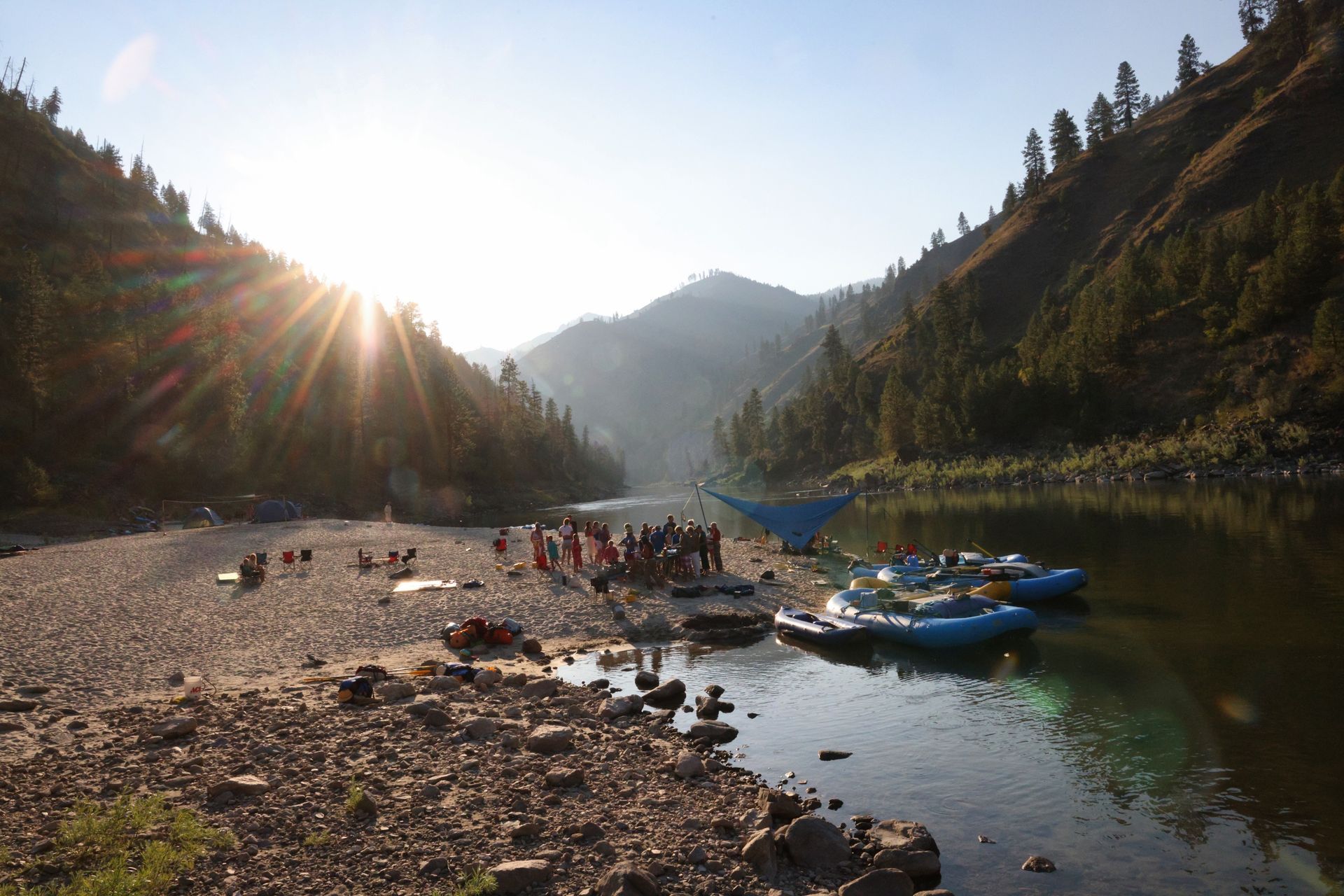
Salmon, Idaho is where you catch the school bus that will take you into the backcountry where Corn Creek boat ramp is located. You may have flown from Boise that morning, or arrived by car the night before.
Just upstream of the put-in you'll see where the confluence of the Middle Fork and the Main meet, with the takeout shortly thereafter. It's not only a place where two rivers converge, but two large adventures as well.
Why They Call It the River of No Return
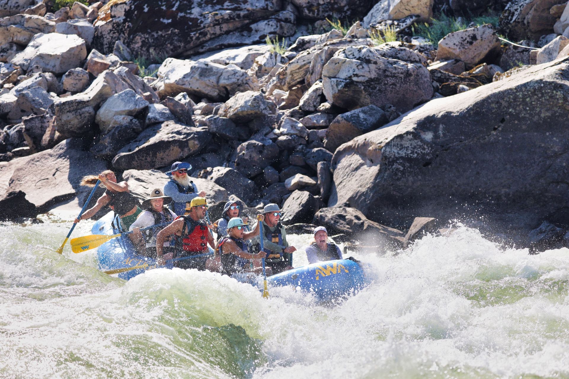
The Salmon runs fast and steadily downhill through a canyon with no road, and before engines, that meant travel was one-directional. Boats could go down. They could not come back up. So the crews who ran freight down the Salmon built heavy wooden scows, floated them to the bottom, and then broke them up and sold the wood, because there was no way to bring them home.
The wilderness that surrounds the river carries the same name: the Frank Church–River of No Return Wilderness, the largest roadless area in the lower 48. Two and a half million acres, and not one road through it.
Get a Waterproof Salmon River Map Guidebook
For a map to take on the water, we recommend the waterproof RiverMaps guide to the Middle Fork and Main Salmon Rivers, sold in the Western River store. It is the mile-by-mile guide Idaho river runners actually carry, and it covers both of the forks Western River runs up here.
Adventure with confidence
Frequently Asked Questions
Where does the Salmon River begin and end?
The Salmon rises in central Idaho and runs west and north through the Frank Church Wilderness before joining the Snake River. The three most popular sections are: the Middle Fork, the Main Salmon, and the Lower Salmon.
Where is the Main Salmon River?
The Main Salmon runs through central Idaho, inside the Frank Church–River of No Return Wilderness. Western River's route covers 82 miles of it, from North Fork and Corn Creek to Carey Creek take-out, above Riggins.
The headwaters of the Main Salmon begin near Stanley, Idaho.
Why is the Salmon River called the River of No Return?
Because boats could go down it but not back up. The current was too strong to row against, so freight crews floated wooden scows to the bottom of the canyon and broke them up for lumber rather than fight the river home.
What towns are on the Salmon River in Idaho?
Riggins is near the Main Salmon take-out. Beautiful and quaint McCall, Idaho is where guests stay overnight before heading to Boise and beyond.
What are the three sections of the Salmon, and which should I raft?
The Middle Fork is the wilderness whitewater run, 100 miles and 100 rapids, Class III to V.
The Main Salmon is the big-water classic, 82 miles, Class II to III+.
The Lower Salmon is the gentlest, 74 miles through four canyons with warm water and sandy beaches. Each has its own map page.
How hard are the Main Salmon rapids?
Class II to III+ on the International scale. Because the Salmon is free-flowing with no dam upstream, the rapids run biggest with the June snowmelt and mellow through the summer.
Still curious to learn more?
See more common questions or contact us.
Plan Your Salmon River Trip
Five days on Idaho’s Main Salmon, playful rapids, sandy beaches, and warm river days, with time to unwind, explore, and soak in the rhythm of a true wilderness escape.
- Begins: Boise or Salmon, ID
- Best for: Rapids & beaches
- Rapids: 50 Class II-IV
- Ages: June 12+ Jul/Aug 6+
Request Your Free Trip Catalog
Explore our complete collection of rafting adventures across the Grand Canyon, Utah, Idaho and Oregon. This full-color catalog includes detailed trip overviews, sample itineraries, maps and planning guidance to help you compare destinations and choose the experience that's right for you.