Frank Church–River of No Return Wilderness, Idaho
Middle Fork Salmon River Map: Rapids, Hot Springs and the Wilderness Route
The Middle Fork of the Salmon is the river other rivers get compared to. One hundred miles. One hundred rapids. It runs the length of the Frank Church–River of No Return Wilderness, the largest roadless area in the lower 48, and in one hundred miles it does not pass a single road, bridge, or town.
It starts high, at Boundary Creek, and drops 2,700 feet on its way to Cache Bar. Then it begins as a tight, technical creek in the pines, and it ends between the granite walls of Impassable Canyon, where the cliffs come straight out of the water and there is no trail along the bank because there is nowhere to put one.
The part nobody expects? There are hot springs, delicious camp meals, and five star-filled nights along the way.
Quick Facts: Middle Fork Salmon River
- Length: 100 river miles, Boundary Creek to Cache Bar
- Rapids: 100 rapids, Class III to V
- The finale: Impassable Canyon, where the granite walls meet the water
- Hot springs: Yes, on the river
- Season: June through August
- Trip:
Middle Fork 6-Day
KEY DIFFERENCES:
The Middle Fork of the Salmon River begins as a mountain stream and during the course of the 5-6 day trip into a full-fledged river carving through high granite cliffs. Not only the river itself changes character, but the surroundings as well, making this one of the world's best multi-day rafting trips anywhere.
Middle Fork Salmon River Map by Trip
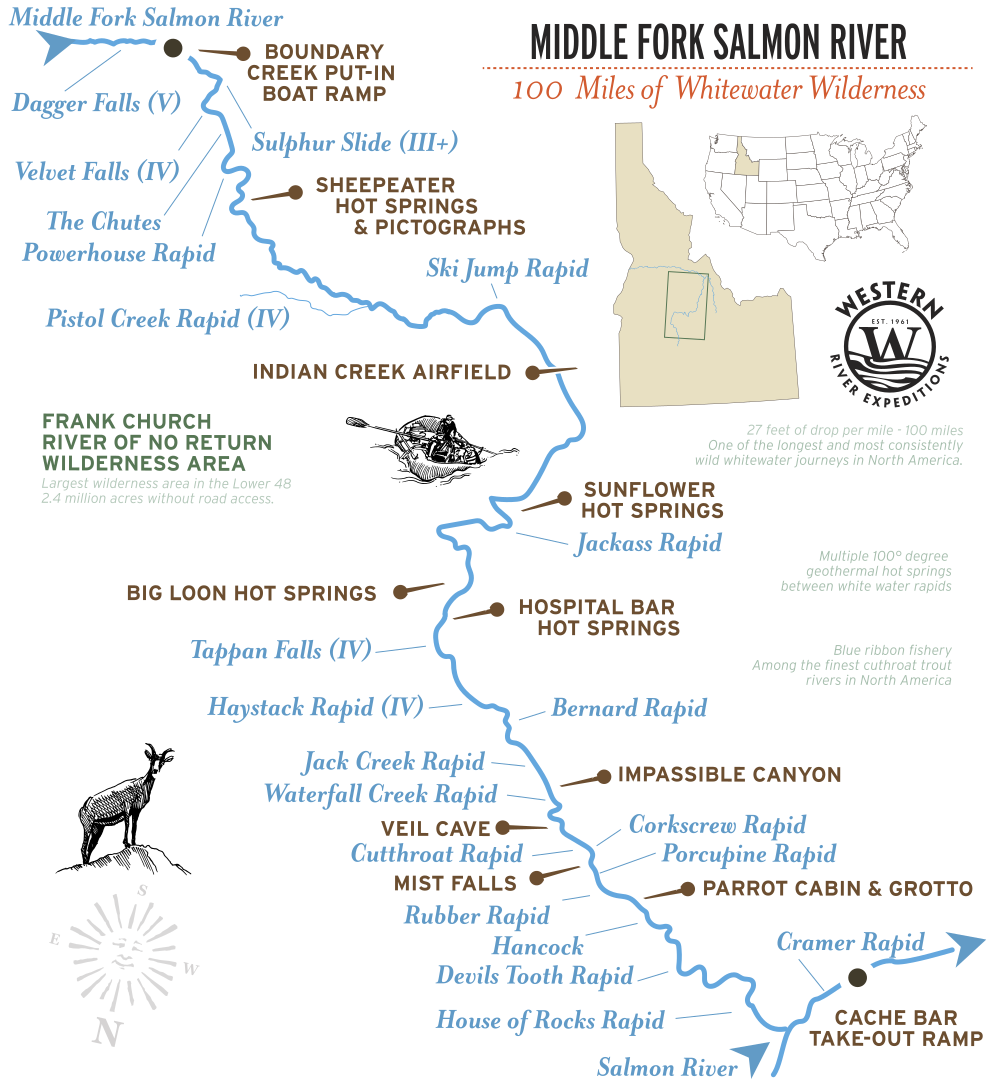
Middle Fork 6-Day Route
The Middle Fork begins high in Idaho's Salmon River Mountains, where the river is narrow, swift, and closely hemmed by forest. During the first days, the rapids come quickly as the river descends through a steep mountain canyon. Farther downstream, the canyon gradually widens, tributaries like Big Creek join the river, and the route passes hot springs, historic cabins, and some of the best-preserved Native American rock art in the Frank Church Wilderness.
The final chapter is
Impassable Canyon, where sheer granite walls close around the river for the last miles to Cache Bar. There are no roads, no trails, and no practical way through except by water, making it one of the defining landscapes of the Middle Fork and a fitting end to one of North America's classic wilderness river journeys.
At a glance:
100 river miles, 100 rapids, Class III to V, 6 days, Boundary Creek to Cache Bar.
The river changes dramatically from mountain stream to granite wilderness corridor.
Middle Fork Rapids by Mile
The Middle Fork uses the International Scale of River Difficulty, Class I to V, the standard system. This is the most demanding of the four Idaho rafting trips Western River offers. The Middle Fork has plenty of Class III to V rapids, with about 100 rapids over 100 miles.
The Middle Fork is free-flowing. There is no dam. It runs highest and pushiest with the June snowmelt and drops through the summer, and at low water the same rapids turn technical as the rocks surface.
| RIVER MILE | RAPID | CLASS | WHAT IT IS |
|---|---|---|---|
| 91.3 | Rubber Rapid | III+/IV | One of the bigger drops in Impassable Canyon. Straightforward at low water; big hydraulics that flip boats at high flows |
| 98.4 | Cramer Creek | IV | Formed by a flash flood in 2003, which is recent enough that some guides remember the river before it |
Places to Know Along the Middle Fork
The Middle Fork is a rich corridor of hot springs and rock art.
| RIVER MILE | PLACE | WHAT IT IS |
|---|---|---|
| ~6.9 | Trail Flat Hot Springs | One of the first significant stops below Boundary Creek, fed by thermal aquifers |
| 32.6 | Sunflower Hot Springs | The other hot spring river runners talk about |
| 26.5 | Sheepeater pictographs | Rock art, hunting blinds, and teepee rings left by the Mountain Shoshoni |
| 57 | Big Creek | The confluence that marks the start of Impassable Canyon |
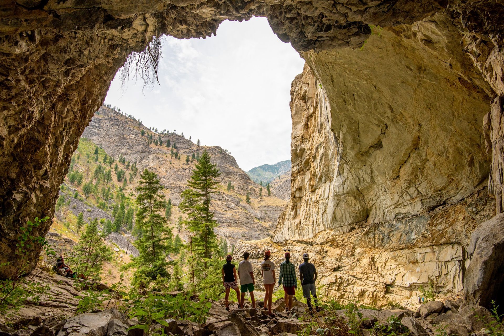
| 57-75 | Impassable Canyon | Sheer granite walls rising from the water. No trail along the river |
How You Reach the River
The Middle Fork launches at Boundary Creek, at 5,700 feet, and takes out 100 miles downstream at Cache Bar, on the Main Salmon. In between, the river drops 2,700 feet and passes nothing: no road, no bridge, no town.
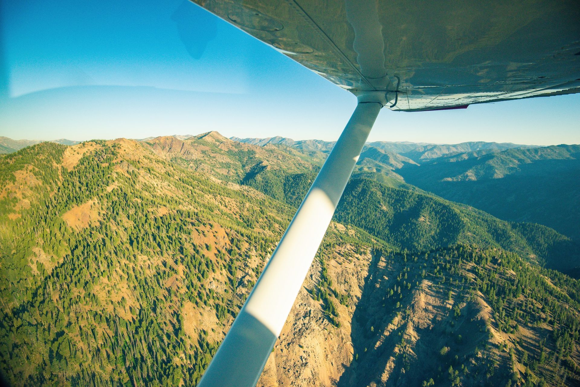
When water levels drop, a scenic flight to the Indian Creek put-in will be the starting point to your Middle Fork adventure.
Inside the Frank Church River of No Return Wilderness
The Middle Fork does not merely pass through the wilderness. It is the spine of it.
The Frank Church–River of No Return Wilderness is the largest roadless area in the lower 48 states, and the Middle Fork runs one-hundred miles through it, with a rapid for every mile. That is why the river feels the way it does: a hundred miles and a hundred rapids through places with names like Impassable Canyon. If you're on foot the name might be true, but for the river rafters it's simple: once you launch at Boundary Creek, the river is the only way out.
Get a Waterproof Middle Fork Map Guidebook
For a map to take on the water, we recommend the waterproof RiverMaps guide to the Middle Fork and Main Salmon Rivers, sold in the Western River store. It is the mile-by-mile guide Idaho river runners carry, and it covers both forks.
Adventure with confidence
Frequently Asked Questions
Where is the Middle Fork of the Salmon River?
In central Idaho, running through the Frank Church–River of No Return Wilderness. It flows 100 miles from Boundary Creek to Cache Bar, where it joins the Main Salmon.
How long is the Middle Fork, and how much of the river do we raft?
One hundred river miles, and this rafting trip covers all of it on the 6-day trip, from Boundary Creek to Cache Bar. The river drops 2,700 feet along the way.
How difficult are the Middle Fork rapids?
Class III to V on the International scale, with about a hundred rapids in a hundred miles. It is the most demanding of Western River's four Idaho river trips. Because the river is free-flowing, it runs biggest with the June snowmelt and turns more technical as flows drop through the summer.
Are there hot springs on the Middle Fork?
Yes, there are 6 notable hot springs on the Middle Fork. Trail Flat, Sheepeater, Sunflower, Whitey Cox, Loon Creek and Hospital Bar.
These hot springs are one of the reasons the Middle Fork is unlike any other whitewater trip in Idaho.
What is Impassable Canyon?
The final stretch of the river, where sheer granite walls rise straight from the water. It begins where Big Creek enters from the left. There is no trail along the bank because the cliffs leave nowhere to build one.
How do the Middle Fork, Main, and Lower Salmon differ?
The Middle Fork is the wilderness whitewater run: 100 miles, 100 rapids, Class III to V. The Main Salmon is the big-water classic, 82 miles, Class II to IV. The Lower Salmon is the gentlest, 74 miles through four canyons.
Is there a printable or waterproof Middle Fork map?
Both. Download our free printable, or pick up the waterproof RiverMaps guide to the Middle Fork and Main Salmon in the Western River store.
Still curious to learn more?
See more common questions or contact us.
Request Your Free Trip Catalog
Explore our complete collection of rafting adventures across the Grand Canyon, Utah, Idaho and Oregon. This full-color catalog includes detailed trip overviews, sample itineraries, maps and planning guidance to help you compare destinations and choose the experience that's right for you.