Southern Oregon, Cascade Range to the Pacific
Rogue River Map: The Wild and Scenic Route, Rapids and Lodges
The Rogue River runs west across southern Oregon, from the Cascade Range to the Pacific Ocean. Along the way it cuts through a stretch of forested canyon so remote, and so worth protecting, that Congress made it one of the original eight rivers named in the Wild and Scenic Rivers Act of 1968.
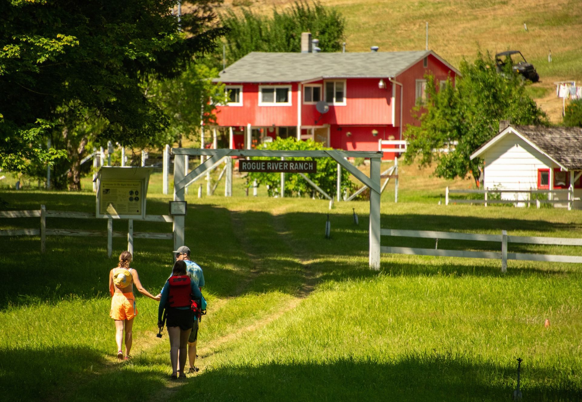
That protected stretch is the one Western River offers: 40 river miles of Class II to IV whitewater, from Merlin down to Foster Bar, through country you cannot drive to. Bears, deer, and river otters live along it. So do a handful of riverside lodges erected before the congressional act, which is what makes the Rogue unusual: you can raft it all day and still sleep in a bed.
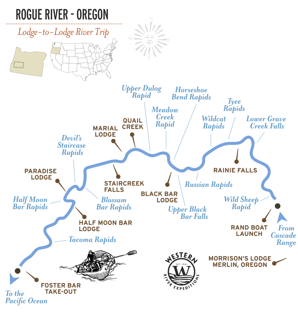
The map below shows the whole river, and the section maps zoom into the Wild and Scenic run: the rapids, the lodges, and the landmarks. They show many of the places you may see on the river, not every rapid or possible stop.
Quick Facts: Rogue River
- Where: Southern Oregon, from the Cascade Range to the Pacific Ocean
- Western River runs: 40 river miles, Merlin to Foster Bar
- Rapids: Class II to IV
- Protected: One of the original eight rivers in the Wild and Scenic Rivers Act
- Season: May through September
- Trips:
Rogue River Lodge-to-Lodge
The Wild and Scenic Rogue
In 1968, Congress passed the Wild and Scenic Rivers Act to protect rivers that were still, in the language of the law, free-flowing and remarkable. Only eight rivers made the original list. The Rogue was one of them.
What that designation protects is the stretch Western River rafts. No roads reach most of it. No development lines the banks. The canyon looks much as it did before the Act, which is the entire point of the Act.
For the official maps and river management information, see the
Bureau of Land Management's Rogue Wild and Scenic River resources.
Rogue River Map by Trip
Western River runs the Rogue two ways. Both cover the same 40 miles of Wild and Scenic river. The difference is where you sleep.
Rogue River Lodge-to-Lodge: 3-Day Route
Raft the full 40 miles by day and pull in each evening at a riverside lodge: a private room, a hot meal cooked for you, and a bed. No tent, no camp setup. It is the reason a lot of people who would never book a camping trip end up on the Rogue.
At a glance:
40 river miles, Class II to IV, 3 days, 2 nights in lodges.
Trips:
Rogue River Lodge-to-Lodge
Rogue River Rapids by Mile
The Rogue's rapids use the International Scale of River Difficulty, Class I to V, the standard system, not the Grand Canyon's 1-to-10 scale. The Wild and Scenic run tops out at Class IV on the rapids guests actually run, which puts it in reach of first-timers and children as young as seven while still delivering real whitewater.
| RIVER MILE | RAPID | CLASS | WHAT IT IS |
|---|---|---|---|
| 34.9 | Rainie Falls ⚠ | V | The Rogue's most famous drop, just below the Grave Creek bridge. Guests walk around. |
| 54 | Mule Creek Canyon | III-IV | A narrow, walled corridor where the river squeezes between rock. It begins at the boulders called Jaws; the hardest part is the Coffee Pot |
| 56 | Blossom Bar | IV | The most technical rapid on the river, a boulder maze that guides read carefully. The one that gives boaters trouble |
Lodges, Landmarks and Wildlife Along the Route
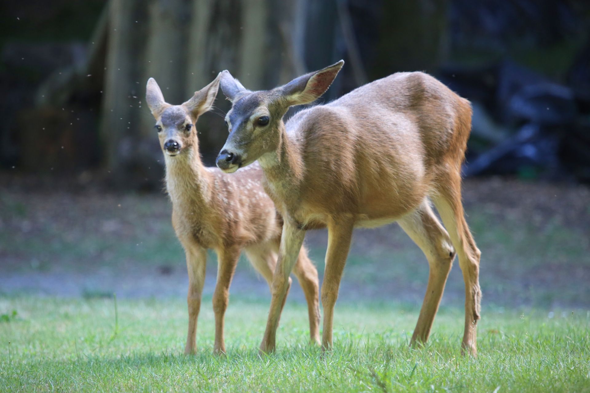
The Rogue is a wildlife river. River otters, deer, and black bears are regularly seen from the boats. And it is one of the few wilderness runs in the West where the lodges are part of the landscape.
| River Mile | Place | What it is |
|---|---|---|
| 34.9 | Rainie Falls | The Rogue's most famous rapid, bypassed through the historic fish ladder. Long set of fun waves. |
| 41.9 | Black Bar Lodge | Historic riverside lodge dating to the 1920s. |
| 53.7 | Marial Lodge | Remote lodge at the former community of Marial. Fun wave train - straightforward in higher flows |
| 57.4 | Paradise Lodge | Historic riverside lodge surrounded by old-growth forest. Treacherous in high flows, entertaining challenge for guides. |
| 57.7 | Half Moon Bar Lodge | Another historic wilderness lodge still serving river travelers. |
| 48.4 | Zane Grey Cabin | Home of the famed western author who helped make the Rogue famous. |
| 67.7 | Foster Bar | End of the Wild & Scenic rafting route. |
How You Reach the River
Rogue trips begin in Merlin, in southern Oregon, where guests meet. The boats launch at Rand Boat Ramp, which is the put-in for the Wild and Scenic stretch, and run downstream through the canyon to the take-out at Foster Bar. From there a shuttle carries you back to Merlin.
Why the Rogue Was Worth Protecting
The Rogue does not run through desert. It runs through rain forest, which is why it looks like no other rafting destination Western River offers. The canyon is green to the waterline, the river drops in short, technical steps rather than long open wave trains, and the whole 40-mile stretch is close enough to the coast that the weather comes off the Pacific.
That combination, wild water, deep forest, no road, is exactly what Congress was trying to preserve in 1968 when it named the Rogue to the original Wild and Scenic list. More than fifty years later, the stretch you raft is still the stretch the Act describes.
Get a Waterproof Rogue River Map Guidebook
For a map you can take on your trip to see what's next, we suggest a detailed section-by-section river guidebook of the Rogue River. With detailed history, insights, hikes, lodges and other points of interest along the way, it's a great companion to have on the river.
Adventure with confidence
Frequently Asked Questions
Where does the Rogue River begin and end?
The Rogue rises in the Cascade Range in southern Oregon and runs west to the Pacific Ocean. Western River trips cover the 40-mile Wild and Scenic section in the middle of it, from Merlin to Foster Bar.
What is the Rogue River famous for?
It is one of the original eight rivers protected by the Wild and Scenic Rivers Act of 1968. That designation preserved the roadless forest canyon that Western River's trips run through, and it is why the river still looks the way it does.
What is the Wild and Scenic section of the Rogue, and where is it?
It is the congressionally protected stretch of the river, and it is the section Western River offers Rogue River trips on: 40 river miles from Merlin down to Foster Bar, through forested canyon.
How hard are the Rogue River rapids?
Class II to IV on the International scale, which is the standard system. The well known drops include Rainie Falls, Mule Creek Canyon, and Blossom Bar, the most technical of them. Children as young as seven raft the Rogue.
Is there a printable or waterproof Rogue River map?
Yes. Pick up the waterproof RiverMaps Rogue River guide in the Western River store for a mile-by-mile guide you can take on the water.
Still curious to learn more?
See more common questions or contact us.
Plan Your Rogue River Trip
Plan Your Rogue River Trip
Three or four days on the Rogue River with lodge-to-lodge comfort, over 35 Class III–IV rapids, and wildlife, finishing with a shuttle back to Merlin.
- Begins: Merlin, OR
- Best for: Lodge to Lodge
- Rapids: 35+ Class II-IV
- Ages: 7+
Request Your Free Trip Catalog
Explore our complete collection of rafting adventures across the Grand Canyon, Utah, Idaho and Oregon. This full-color catalog includes detailed trip overviews, sample itineraries, maps and planning guidance to help you compare destinations and choose the experience that's right for you.