Is the Colorado River Drying Up and Will it Affect Your Grand Canyon River Tour?
"There is still a river flowing despite the drought. There are still fish swimming in the river. There are still river guides hooping and hollering as they make the cut to hit the big wave coming off the big rock that’s now just more exposed."
Headlines about the drought in the West are building up like driftwood against a beaver dam:
Smithsonian Magazine says, “The Colorado River Runs Dry”. ScienceFriday asks, “What Happens When the Colorado River Runs Dry?” The New York Times and USA Today: “Climate Change is Killing the Colorado River”. National Geographic asks, “Can the Colorado River keep on running?” Greenbiz.com offers recommendations: “The Colorado River: What’s Broken and how to fix it”.
The metaphor of driftwood building up behind a beaver dam is a bit ironic since driftwood is an effect of rising water, not declining flows. But just as it is hard to tell the driftwood from the beaver dam, it can be hard to decipher the truth from alarming news stories, especially from their headlines alone. There is a water crisis in the West, and the last twenty years have shown a particular cause for alarm. As GreenBiz concludes accurately, “The Colorado River Basin is the "canary in the mine" for the future of water in the American West.”
What does the West’s trending drought mean to you, our guides, our livelihood on the rivers, and the broader uses of the West’s water?
Boating Until the Rivers Actually Run Dry
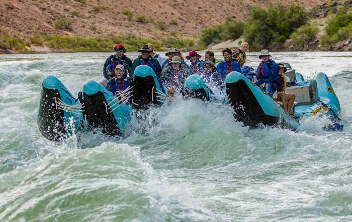
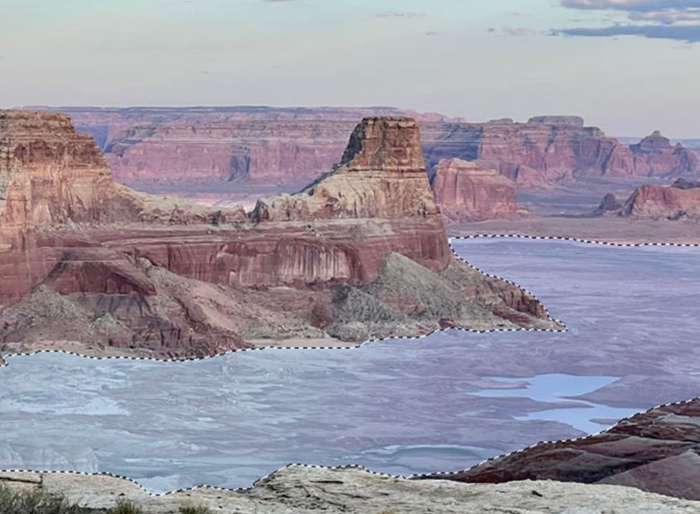
Over the last sixty-plus years in the river rafting business, we’ve seen low water levels, we’ve seen high water levels. We’ve seen giant hydroelectric dams put in place, and just this year we’ve seen water levels drop low enough to potentially render the hydroelectric turbines of Glen Canyon Dam inert within the next 1-2 years. But there is still a river flowing despite it all. There are still fish swimming in the river. There are still river guides hooping and hollering as they make the cut to hit the big wave coming off the big rock that’s now just more exposed. While the “Megadrought” of the last twenty years has proven to be the driest in the last 1200 years, we will simply calibrate the size of the craft to match the size of the river’s flow. Then we will hope and pray for more snow and rain, and do our best to maintain our high standards of customer experience. We’ve done it this way in Utah’s Cataract Canyon since 1961.
The bottom line for the rafting industry is this: Rivers rarely dry up entirely, and as long as there are rivers to run, we will run them. If the reservoirs dry up and there are ancient lakebed rivers to run, we will probably run those too! We know that is a narrow focus, but it may be the very concern that has you reading our blog post. If you’re worried about the river running so dry that the trip you booked a year in advance will no longer be available, rest easy. That’s not what those headlines mean.
What Will Water Flows be Like in 2022, and How They Will Affect My River Trip?
Despite the drought, man-made water releases from a series of reservoirs will keep 2022 water flows higher than expected. Higher than expected water flows like this are rare and could be the last time we will see flows like this in the West if the megadrought persists. Flaming Gorge Reservoir, which straddles the Utah-Wyoming border will release 500,000-acre feet of water over the next 12 months in order to prevent Lake Powell water levels from dipping below hydroelectric capability. Lower Basin states (ie. Lake Mead) will eventually have the use of that water for crops in California. Trying to replicate "normal" flows and natural rythms, most of the water will be released during the hotter summer months - similar to that of a normal winter snowpack melting off and filling the rivers.
"Right now snowpack for the Colorado River Basin is 16% higher than last year (and yes, we definitely ran rivers last year) so things are looking even better this year. We also have the added benefit of higher ground water saturation, thanks to a wetter Fall than the year before. This basically means the ground will not be as thirsty and water will shed more directly into the reservoirs and rivers." - Brian Merrill
This means that water levels in Desolation Canyon and Cataract Canyon (both located between Flaming Gorge and Lake Powell) will see water flows more typical of non-drought (non-megadrought) years. In turn, flows through the Grand Canyon from Lake Powell to Lake Mead will also see fairly normal flows. In all honesty, this could be the last year we see "normal" flows for several years to come. Unless we see consecutive abnormal snowpack years to fill the reservoirs, we can only project lower than normal flows in the coming years.
What do Lower Water Levels Mean for Recreational Rafting?
Is the river half empty or is it half full? More than just a test of whether you're an optimist or a pessimist, there are actual quantifiable reasons why lower water is just fine with us, and for you:RAPIDS: Lower water levels don’t directly equate to diminished white water rapids. Some rapids actually come alive in lower water. Westwater Canyon is an example where higher water "washes out" the rapids because rocks in the channel get so far below the surface that they no longer scrape or ruffle the surface into a white water froth. This makes the rapids no more than fast-moving riffles.
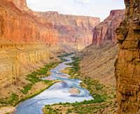
Desolation Canyon, Cataract Canyon, and many rapids in Grand Canyon gain a bit more kick and punch with lower water. In fact, the rapids of the Lower Granite Gorge in the Grand Canyon actually become more technical as massive boulders are exposed and the waves become much larger and more challenging. Conversely, in high water, some rapids get bigger such as the Big Drops in Cataract Canyon, or Crystal and Lava Falls in the Grand Canyon. There are so many different configurations of the canyon walls and rocky river beds that you can find whitewater thrills no matter the water level. From a guide perspective, higher water flows faster, requiring faster, or more anticipated response times between moves. Lower water moves more slowly but reveals more obstacles to maneuver between. It’s all part of the fun and skillset of navigating whitewater rapids!CAMPING: Lower water levels bring broad, sandy beaches. We're talking space for endless fun with games on the beach like Kubb, Spikeball, Frisbee, and timeless sandcastles. Lower water flows provide more space in which to camp, perhaps on a sandbar, that is away from the vegetation. We witness this every year as snowmelt slows and rivers drop into more curvy and sinuous paths between the shoreline.
Another unique option with low water is the opportunity to camp on a sandbar revealed only in low water. Camping on a sandbar can provide a nice flat space for your cot and tent away from vegetation and critters that live nearby. Guides anticipate the camping spots that only become available in lower water.
BUGS: Fun fact: There are fewer bug problems in lower water. What more can we say?
Higher water flowing beyond its banks through the vegetation stirs up our six-legged dessert dwelling insect friends. High water also leaves large puddles of standing water that make a perfect breeding ground for said friends. In lower water months and years, we don't see this cycle and we are a-okay with that.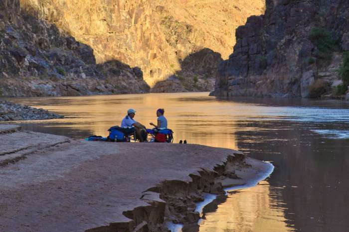
Threats to the Broader Uses of the Colorado River
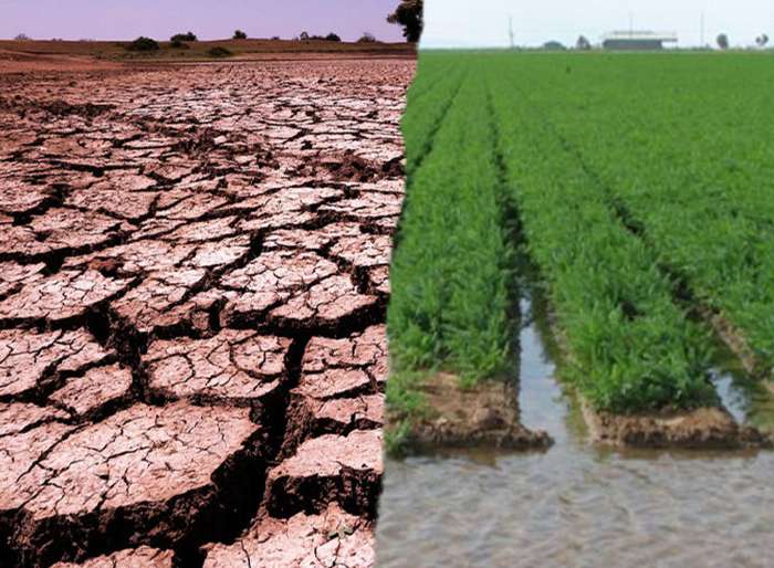
In contrast, and in reference to the alarm outlined in the headlines cited above, rivers in the arid West often don’t meet all the demands placed upon them from conglomerations of cities, and farmlands that have blossomed in the desert like so many rose bushes. It is a legitimate concern. As the non-profit “American Rivers” states, “Life needs rivers”. They recently listed the Colorado River as the #1 Most Endangered River.
Personally, I’m all for clean drinking water, removing pollution, water for crops that feed millions, and even hydroelectric power that allows me to type an electronic blog post. But I'm confused. Is the Colorado River itself endangered, or the overly dependent cities, crops, and hydroelectric demands that are actually endangered? American Rivers states, “The Colorado River system is already operating at a deficit, and climate change is expected to further reduce the river’s flow by 10 to 30 percent by 2050.” What does that mean? It means that on paper the demand for water is greater than the present and foreseeable supply. This is especially true in the lower basin (below Lake Mead and on toward California’s Imperial Valley and the Salton Sea. Learn more about that here: “How the Colorado River’s Future Depends on the Salton Sea”
Perhaps like you, if I’m being completely honest, I am confused about what specific action is proposed to solve the problem. What can you or I do? What can a White House Administration do? Tell people in Phoenix and L.A. they should move? Tell crop farmers in the Imperial Valley to stop producing food? Tell people to stop eating those crops? Tell 25 million people in Arizona, Nevada, California, and Mexico to get their own water?
We take so much for granted. So much driftwood is entangled with the beaver dam.
What Can We Do? Spread the Word: Sustainability
This over-dependency on water that was never there (over-allocation) didn’t begin twenty years ago with the beginning of the worst drought in 1200 years. The slow train-wreck we see today started as early as the 1920’s when the Colorado River Compact divvied-up the water among 7 Western states, and Mexico. On paper there was agreement. But no one consulted the river itself. No one besides John Wesley Powell.
Early warnings. In 1869 Powell led the first river expedition down the canyons of the Green and Colorado Rivers. Although he witnessed first-hand the river’s magnificence and power, he knew that what appeared to be an endless supply, was not. Perhaps the first to preach about sustainability, Powell witnessed and warned in an 1890 Senate Committee meeting that the rivers in the southwest could not sustain overdevelopment. But no one listened. Heedless of Powell’s prophetic warning, the largest dams and reservoirs were built and the desert blossomed like so many rose bushes - possibly in a way Powell could never have imagined. If you want to read more about this, read the Smithsonian Magazine article, “The Visionary John Wesley Powell Had a Plan for Developing the West, But Nobody Listened”
Don’t mistake that it is all water under the bridge at this point. Bad thinking (non-sustainable thinking) in some places like California continues to carry more debris toward the beaver dam. For example, one of the solutions agreed upon this year by the Lower Basin States is to keep some of their allocated water in Lake Powell AS LONG AS IT IS COUNTED IN LAKE MEAD’S LEVELS so that they don’t have to go into lower Tier 2b restrictions and reduce their water use. If we pretend the water is there, then they get to keep on using it. Is that sustainable? Maybe it would be wise to not grow high-use crops like alfalfa and rice in this region.
Looking for hope that it can be done? Look at Las Vegas. The Las Vegas Valley Water District states, “The community used 24 billion gallons less water in 2020 than in 2002, despite a population increase of more than 780,000 residents during that time. This represents a 47 percent decline in the community’s per capita water use since 2002.” Even if we get two extraordinary water years to fill the reservoirs, like in the 1980’s, places like Las Vegas should continue to conserve as they are. It is possible to live sustainably! It’s just more evidence that what happens in Vegas, stays in Vegas! I couldn’t resist.
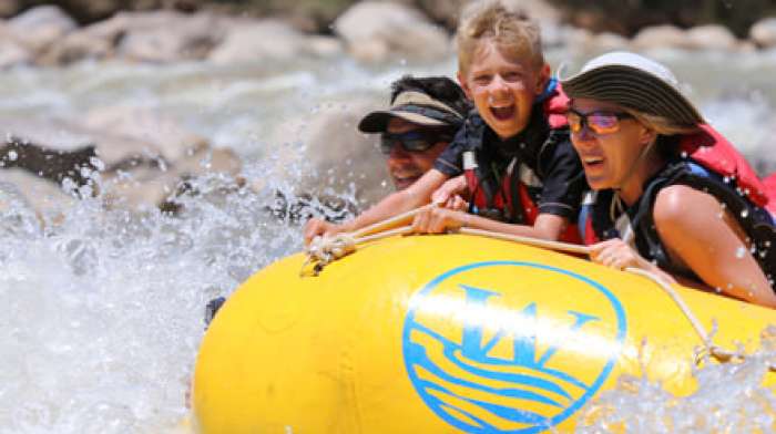
What can we do now? I say we pray for snow, do the rain dance, practice conservation, and teach others to think in more sustainable ways. But while the rivers are running, come run the rivers. It might be the best kick-start to being an activist for rivers that you could ever do!
Links to Articles Referenced in Opening Paragraph
- “The Colorado River Runs Dry” - Smithsonian Magazine
- “What Happens When the Colorado River Runs Dry?” - Science Friday.com
- “The Colorado River: What’s Broken and how to fix it” - GreenBiz.com
- “Climate Change is Killing the Colorado River” - The New York Times
- “Climate change is drying up the Colorado River, studies say” - USA Today
- “Can the Colorado River keep on running?” - National Geographic

Related Trips
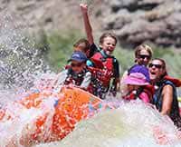
Grand Canyon Rafting Trips
Experience a 3 to 7 day expedition filled with whitewater excitement, spectacular waterfalls waterfalls and starry nights.
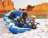
Cataract Canyon 4 Day Trip
Experience 4 Days through the heart of Canyonlands National Park.