GRAND CANYON, ARIZONA
Colorado River Map
From its headwaters high in Rocky Mountain National Park, the Colorado River travels roughly 1,450 miles to the Gulf of California. Its drainage basin spans seven U.S. states and Mexico, while its most famous whitewater is concentrated in the deep canyon country of Utah and Arizona.
This map follows the Colorado from source to sea and identifies the sections that Western River runs: Castle Valley near Moab, Cataract Canyon through Canyonlands National Park, and the Grand Canyon. Begin with the full-river overview, then explore the section maps below for trip routes, rapids, landmarks, put-ins and take-outs.
Quick Facts: Colorado River
- Length: Approximately 1,450 miles
- Headwaters: Rocky Mountain National Park, Colorado, near 10,200 feet
- Drainage: Seven U.S. states and Mexico
- Largest tributary: The Green River
- Western River sections: Castle Valley, Cataract Canyon and Grand Canyon
- Whitewater: Gentler water near Moab, Class III-V in Cataract Canyon and the Grand Canyon's own 1-10 scale
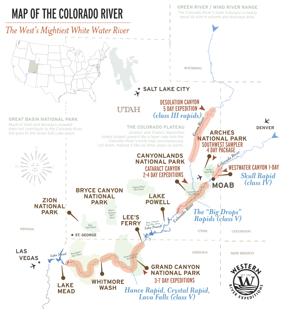
Sections of the Colorado River and Where Western River Runs
The Colorado River is broken into at least a dozen distinct runnable sections over its 1,450 miles. Here is the river in downstream order, with the stretches Western River runs called out in depth and the rest named for orientation.
westwater canyon 1-day
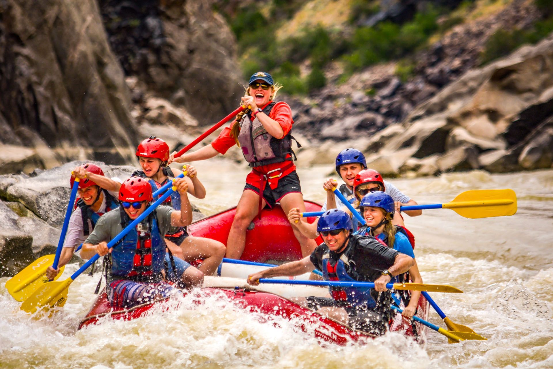
Just across the Utah line, the Colorado drops into Westwater Canyon, a tight black-rock gorge with punchy Class III–IV rapids, run as a day or overnight trip. Western River's sister company,
Moab Adventure Center, runs Westwater.
castle valley - Moab, Utah
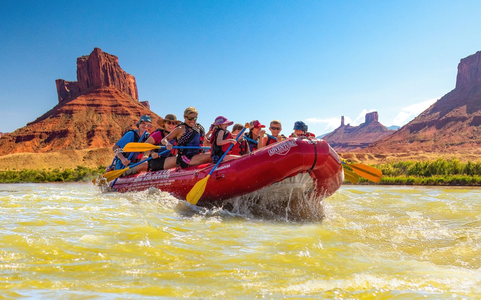
Upstream of Moab, beneath Fisher Towers and the La Sal Mountains. This scenic 20-mile stretch through Castle Valley offers Class I–III water that’s ideal for first-time rafters and families, and is the river adventure featured in
Western River’s Southwest Sampler.
Cataract canyon moab, utah
Below Moab, the Colorado meets the Green River at the Confluence and enters Cataract Canyon: roughly 30 Class III–V rapids, including the Big Drops. Western River explores this legendary stretch on both
4-day Classic and
2-day Express trips.
grand canyon, arizona
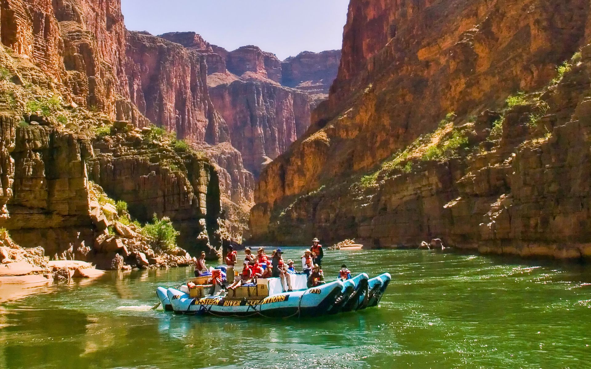
Below Lake Powell, the Colorado enters the Grand Canyon, flowing 280 miles from Lees Ferry to Lake Mead. Explore the upper two-thirds (188 miles) on a
6-Day or
7-Day trip, and the lower third (92 miles) on a
3-Day or a
4-Day Bar Ten Ranch trip.
Colorado River Map by Section
Westwater Canyon - Moab, Utah
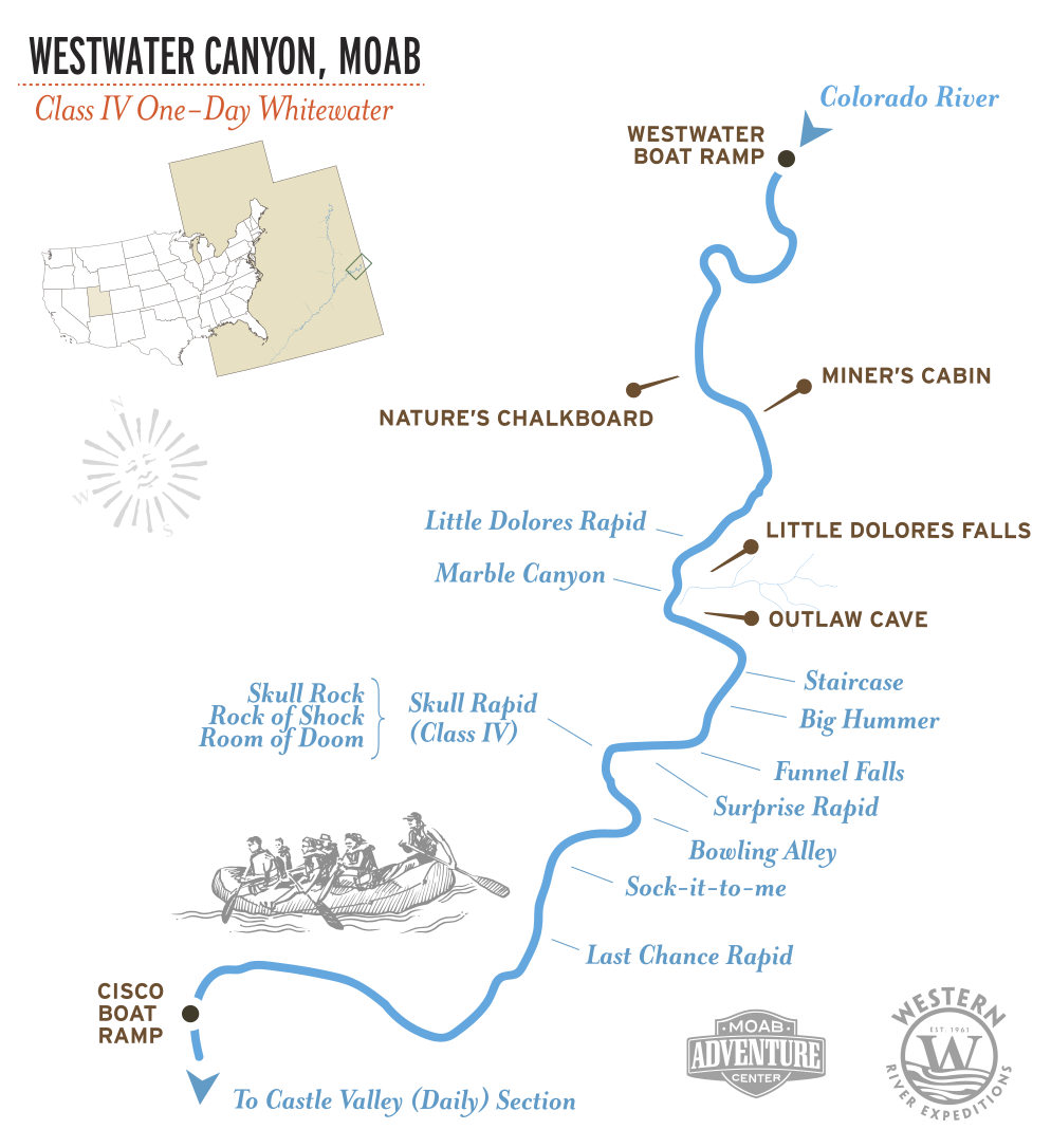
Just across the Utah line, the Colorado squeezes into Westwater Canyon, a narrow black-rock gorge packed with punchy Class III–IV rapids, including Skull Rapid. It is the most concentrated whitewater near Moab and is sold as a 1-day trip by Western River’s sister company, Moab Adventure Center.
At a glance:
30 river miles, 10 named Class I–IV rapids
Trips: 1-day trip operated by
Moab Adventure Center
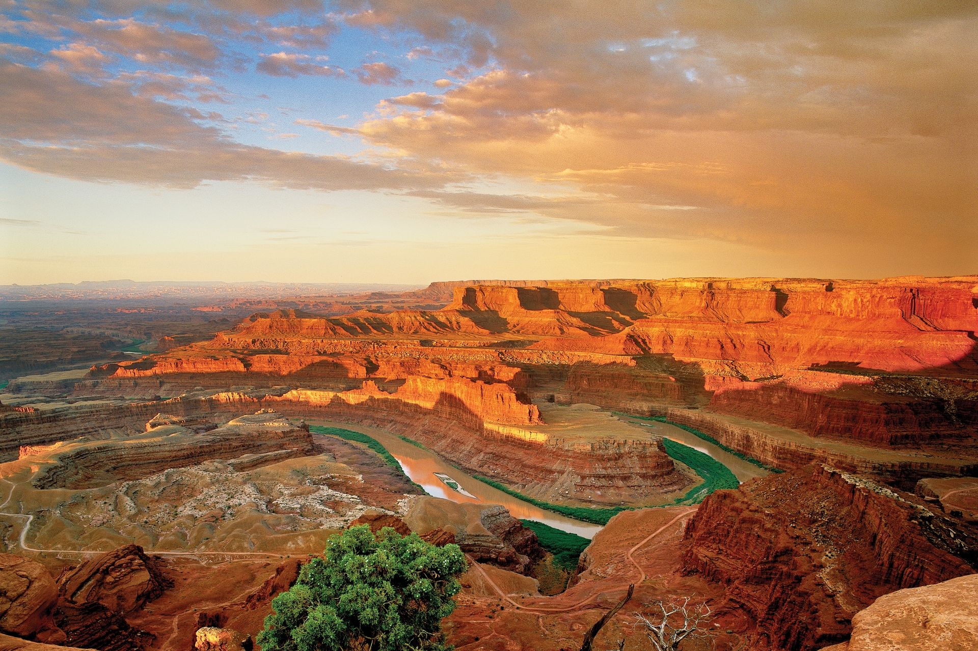
The Moab / Castle Valley Stretch
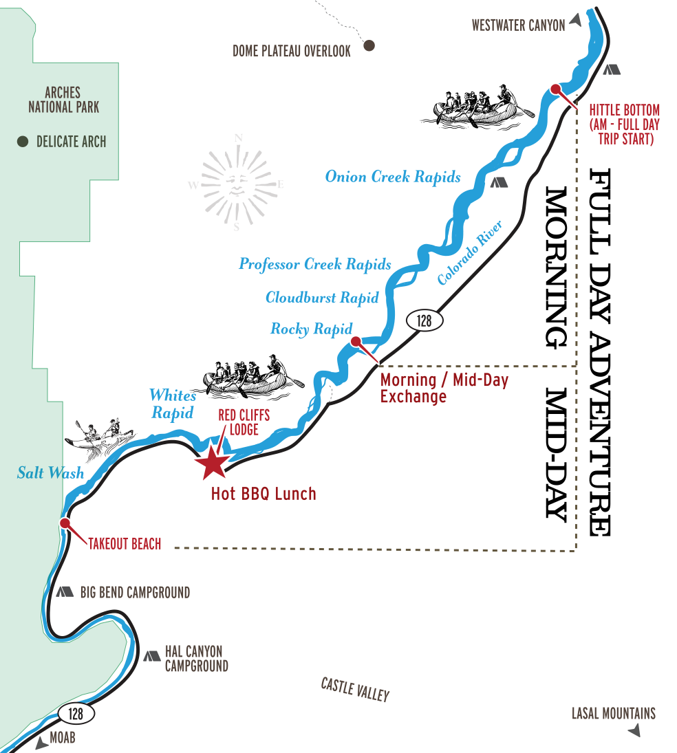
Upstream of Moab, the Colorado runs scenic and splashy through Castle Valley, Class I–III water beneath red sandstone walls and the La Sal Mountains. It is the gentlest Colorado River water Western River runs, and the river portion of the Southwest Sampler, a 4-day Moab package that pairs the float with Arches National Park and a Hummer safari.
At a glance: 20 river miles, 6 named Class I–III rapids, 1 riverside night.
More on this stretch: Colorado River in Moab.
Trips:
Southwest Sampler 4-Day.

Cataract Canyon - Canyonlands N.P.
Cataract Canyon is the Colorado at full volume. Above the Confluence, the river drifts flat through Stillwater Canyon; below it, the combined Green and Colorado funnel into a steep, narrowing gorge and roughly 30 rapids stack up across the canyon, building to the Big Drops. Western River runs the full 95 miles on two trips: the
Classic 4-Day, which returns by scenic flight over Canyonlands, and the
Express 2-Day aboard the motorized Snout-Rig returns to Moab via ground shuttle.
At a glance: 95 river miles, ~30 Class III–V rapids, 3 nights (Classic) or 1 night (Express).
Grand Canyon, Arizona
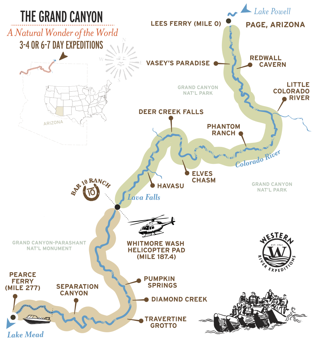
The Grand Canyon is the largest section Western River runs on the Colorado River. The map shows where the trips sit on the river; the dedicated Grand Canyon map breaks the corridor into the upper 6 and 7-day route and the lower 3 and 4-day route, with every named rapid and side canyon plotted.
At a glance:
280-mile canyon corridor; Western River trips cover the upper 188 miles (6-7 Day Trips) or lower 92 miles (3-4 Day Trips); rapids are rated on the Grand Canyon’s 1–10 scale.
Signature Rapids by Colorado River Section
The named whitewater on the stretches Western River runs in Utah. For the Grand Canyon rapids, see the
Grand Canyon River Map.
| SECTION | RAPIDS | CLASS |
|---|---|---|
| WESTWATER CANYON | Funnel Falls, Skull, Sock-it-to-me, Last Chance | I-IV |
| MOAB / CASTLE VALLEY | Onion Creek, Professor Creek, Cloudburst, Rocky Rapid, Whites | I–III |
| CATARACT CANYON | Brown Betty, Capsize, The Big Drops, Imperial | I–V |
| GRAND CANYON | Hance, Hermit, Crystal, Lava Falls | 1-10 rating scale (I-V) |
Cataract Canyon has roughly 30 named rapids in all; the Big Drop series is the concentrated heart of the whitewater. Class V is possible in Cataract during peak runoff in May and June.
Grand Canyon rapids: The Grand Canyon's whitewater is rated on the canyon's own 1-to-10 scale rather than the International Class system. Its marquee rapids include Lava Falls, the most famous in North America and rated 9 to 10 at most water levels, along with Crystal and Hermit. See every named Grand Canyon rapid on the
Grand Canyon River Map.
Landmarks Along Western's Colorado River Sections
| PLACE | SECTION | WHAT IT IS |
|---|---|---|
| VISHNU SCHIST GEOLOGY | Westwater Canyon | Same ancient rock layer found in Grand Canyon's inner gorge |
| FISHER & CASTLETON TOWERS | Moab / Castle Valley | Red sandstone spires rising above the river |
| LA SAL MOUNTAINS | Moab / Castle Valley | Snowcapped peaks on the southern skyline |
| THE CONFLUENCE | Cataract Canyon | Where the Green River joins the Colorado and Cataract Canyon begins |
| CANYONLANDS NATIONAL PARK | Cataract Canyon | The remote national park Cataract Canyon runs through |
| THE LOOP | Cataract Canyon | A sweeping bend of the Colorado in Canyonlands |
| REDWALL CAVERN | Grand Canyon | Massive undercut cavern in bend of the river |
| LITTLE COLORADO RIVER | Grand Canyon | Shockingly bright blue tributary (when not muddy from rainfall) |
| ELVES CHASM | Grand Canyon | Waterfall grotto very unique to the Grand Canyon |
| DEER CREEK FALLS | Grand Canyon | Hundred-foot falls thundering to the river's edge from hanging slot canyon |
| HAVASU CREEK | Grand Canyon | Stunning blue-green waterfalls, pools, and lush vegetation |
National landmarks surrounding the Colorado River: More than a dozen National Parks, Monuments, and landmarks surround the Colorado River. The Colorado River may not be the longest or largest volume, but its drainage has, arguably, carved the most celebrated landscapes on planet Earth.
Where to Access the Colorado River
Moab, Utah is the natural confluence for all Colorado River and Green River rafting trips. Cataract Canyon trips put in downstream of Moab at Potash Boat Ramp, The Southwest Sampler begins just 30 minutes upstream of Moab, and Westwater further up.
Grand Canyon trips depart from Las Vegas near Lake Mead, or at the head of the Grand Canyon in Page, Arizona - near Glen Canyon Dam at Lake Powell. Full access details for the Grand Canyon, including the helicopter and jetboat legs, are on the
Grand Canyon River Map.
The River That Carved the West
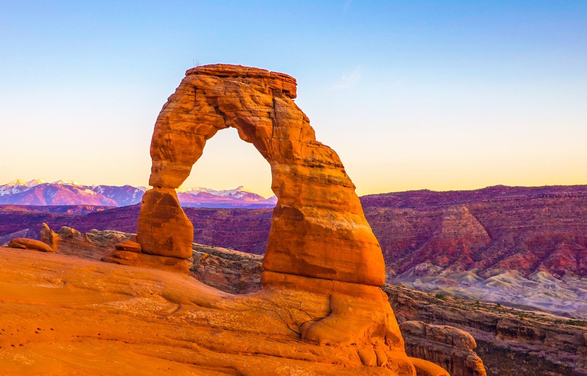
The Colorado River is not America’s longest river, nor its largest by volume. Its distinction is what it has carved. Across its watershed, more than a dozen national parks, monuments, and iconic landscapes rise from canyons, mesas, arches, cliffs, and desert plateaus shaped by the river and its tributaries. Rocky Mountain, Arches, Canyonlands, Grand Canyon, and the great canyon country of the Colorado Plateau all belong to this remarkable drainage.
From a small mountain stream near the Continental Divide, the Colorado gathers the Green, Gunnison, Dolores, San Juan, Little Colorado, and countless smaller tributaries as it travels southwest. Together, these rivers have cut through immense layers of stone, exposing a geological story hundreds of millions of years deep.
It isn’t the biggest river in America. It may simply have carved the most celebrated landscape on Earth.
Get a Waterproof Colorado River Map Guidebook
For travelers who want a map to carry on the river, we recommend the waterproof Belknap river guide for this stretch of the Colorado, sold in the Western River store. It is the rapid-by-rapid, mile-by-mile guide river runners have used for decades, and it holds up to a full trip on the water.
Adventure with confidence
Frequently Asked Questions
Where does the Colorado River start and end?
The Colorado begins as snowmelt in the Never Summer Mountains of Rocky Mountain National Park, near La Poudre Pass at about 10,200 feet, and runs roughly 1,450 miles southwest to the Gulf of California, though today its flow is often used up before it reaches the sea. Its largest tributary, the Green River, joins it at the Confluence in Canyonlands, and from there the combined river carves Cataract Canyon and, downstream, the Grand Canyon.
How many miles of the Colorado does Western River raft?
424 miles in total. Where the Colorado River drops into Utah through Westwater Canyon, Western River runs about 30 miles and roughly 20 miles through the Castle Valley stretch near Moab, 95 miles of Cataract Canyon, and the entire length (279 miles) of the Grand Canyon on multi-day trips, all ranging from 2 to 7 days.
Which sections of the Colorado can you raft?
The river has a dozen-plus runnable sections, but the whitewater is concentrated in a few canyons. Western River runs the two greatest multi-day sections, Cataract Canyon and the Grand Canyon, plus the Castle Valley and Westwater sections near Moab. Our sister company Moab Adventure Center runs Westwater Canyon and the Southwest Sampler.
How many rapids are in Cataract Canyon, and how hard are they?
Cataract Canyon has roughly 30 rapids rated Class III–V, including the back-to-back Big Drop series. Class V is possible during peak snowmelt in May and June. The Moab stretch is gentler, Class I–III.
Is there a printable or waterproof Colorado River map?
We recommend the waterproof Belknap river guide maps for the canyon sections of Westwater, Cataract Canyon, and Grand Canyon, all available in the Western River store.
How do you get to the put-ins?
The Utah sections launch from Moab (about four hours from Salt Lake City); the Grand Canyon trips depart from Las Vegas and Page, Arizona.
What is the Moab Adventure Center?
Western River created the Moab Adventure Center in 2003 to curate and provide the one-stop for adventure for day trips in Moab, Utah. This includes our one-day and half-day rafting trips, canyoneering, Hummer tours and more.
Still curious to learn more?
See more common questions or contact us.
Plan Your Colorado River Trip
Western River runs the Colorado's two greatest whitewater canyons and the gentlest scenic stretch in between. Pick the section that fits your group.
Raft through Canyonlands National Park, run the legendary Big Drops, and camp beside the Colorado River beneath the stars. Return to Moab on a scenic flight.
- Begins: Moab, Utah
- Best for: Whitewater
- Rapids: 30+ Class III-V
- Ages: 12+ (10+ Jul–Sep)
Raft 95 miles of the Colorado River in two days. Run the legendary Big Drops and sleep beside the river in Canyonlands National Park before a shuttle back to Moab.
- Begins: Moab, Utah
- Best for: Quick Thrills
- Rapids: 30+ Class III-V
- Ages: 12+
Experience an overnight Colorado River rafting trip, a guided tour of Arches National Park, an off-road adventure on Hell's Revenge, and two nights at the Marriott.
- Begins: Moab, Utah
- Best For: Variety (3 trips)
- Rapids: 6 Class I-III
- Ages: 5+
Planning a Grand Canyon trip?
Western River runs the Colorado through 187 miles of the canyon on trips ranging from 3 to 7 days.
Request Your Free Trip Catalog
Explore our complete collection of rafting adventures across the Grand Canyon, Utah, Idaho, and Oregon. This full-color catalog includes detailed trip overviews, sample itineraries, maps, and planning guidance to help you compare destinations and choose the experience that’s right for you.